
|
The coverage for "The 045" are a little larger due to the antenna's height above the average terrain (HAAT). The software has a km/mile limit, so some of the edges are rounded off. Again, these coverage maps are purely based on setup, configuration, and propagation. YMMV! GREEN depicts low power mobiles and handheld devices, while RED depicts coverage for mobiles with high-gain antennas and base stations with antennas >10ft above ground. 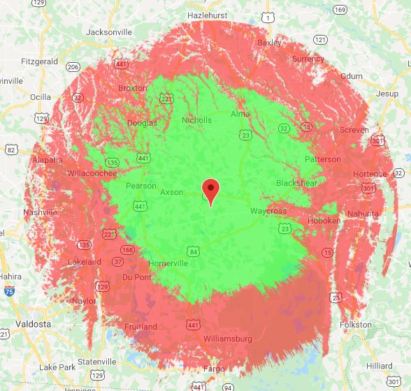 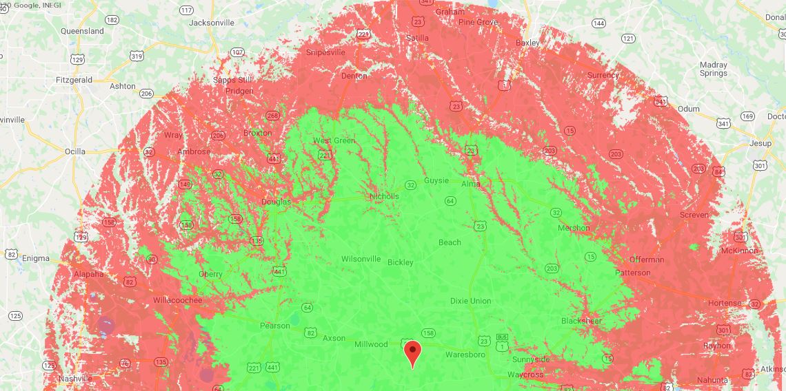 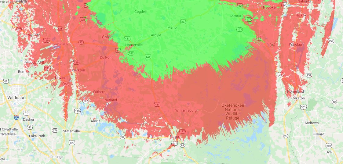
1 Comment
The Digi/iGate on 144.390 has a much larger footprint if you're operating via base station or through another Digipeater. The RED depicts >50w nodes with 1/4 wave antenna >10ft off the ground. The GREEN depicts 5-50w nodes (mainly consisting of mobile rigs) and mobile antennas. 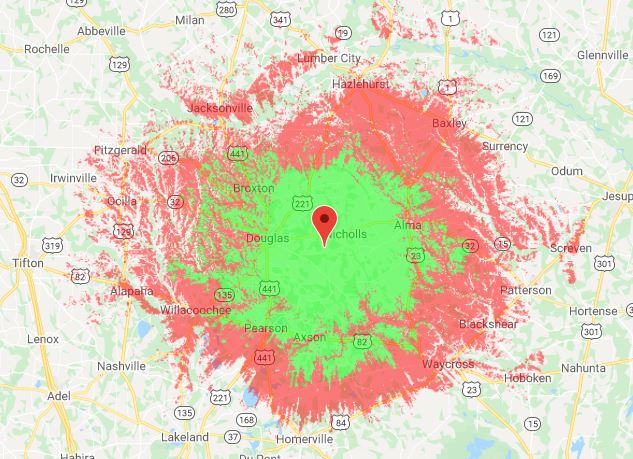 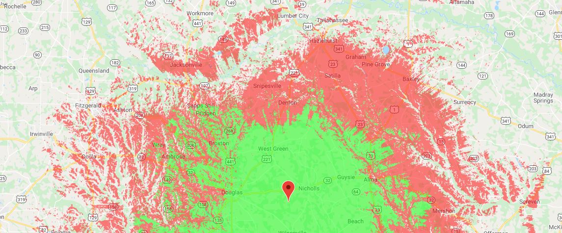 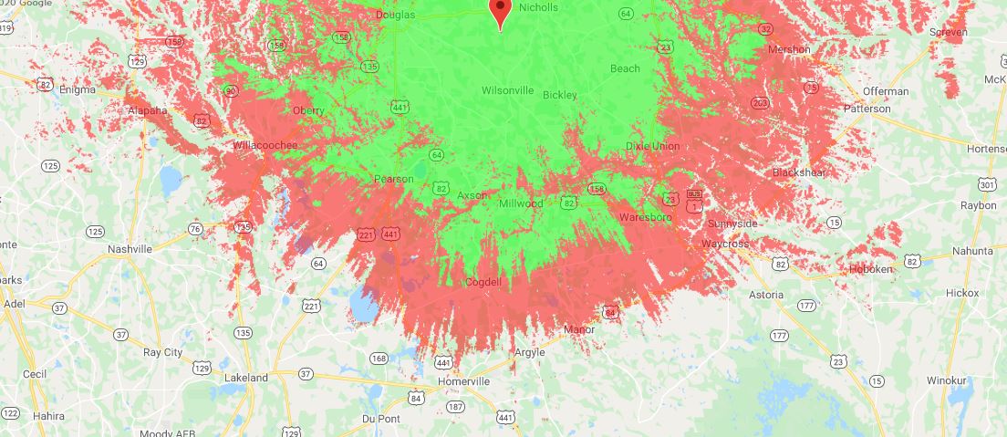 This is an ITM (Irregular Topography Map), also known as a Longley-Rice map. It accounts for signal strength vs land elevation and topography. Notice the signal strength dips nearest rivers and creeks such as the Satilla and Altamaha. The GREEN depicts handheld units and lower-power mobile units. The RED depicts mobile units with 5/8 wave antennas and base stations with high gain antennas >10ft high. The repeater can be reached at much greater distances (with reports from McRae, Moultrie, Adel, Hoboken, and Valdosta) with a moderate base station with at least a 30ft high antenna mast. 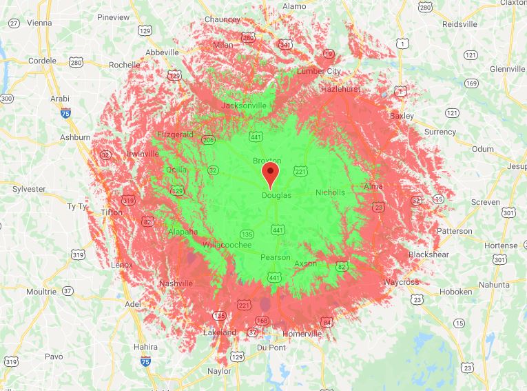 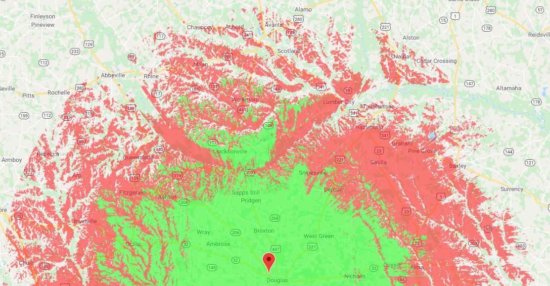 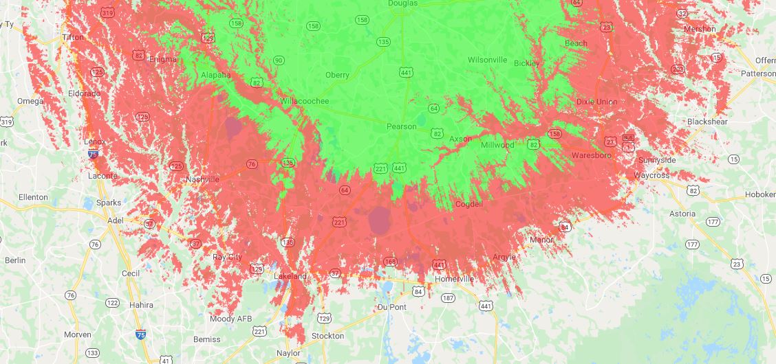 |
