|
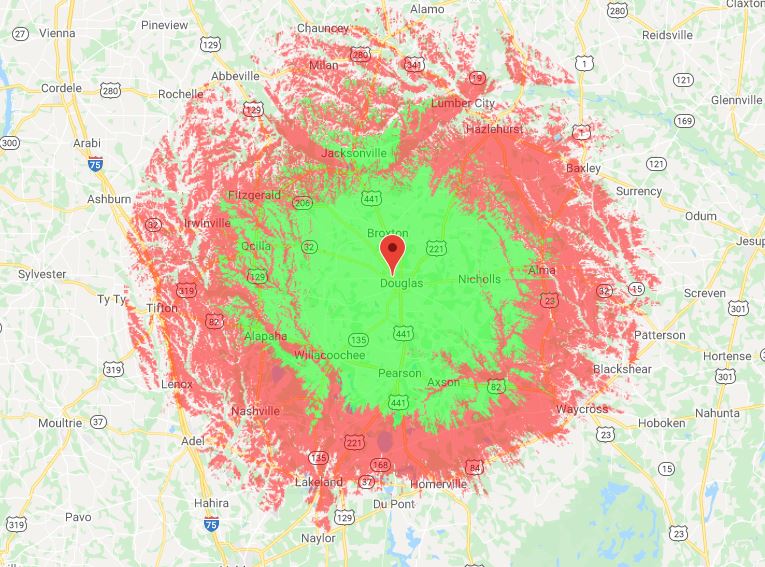
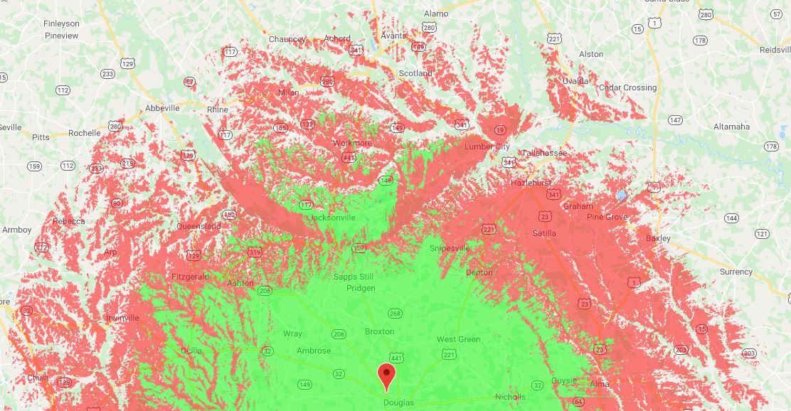
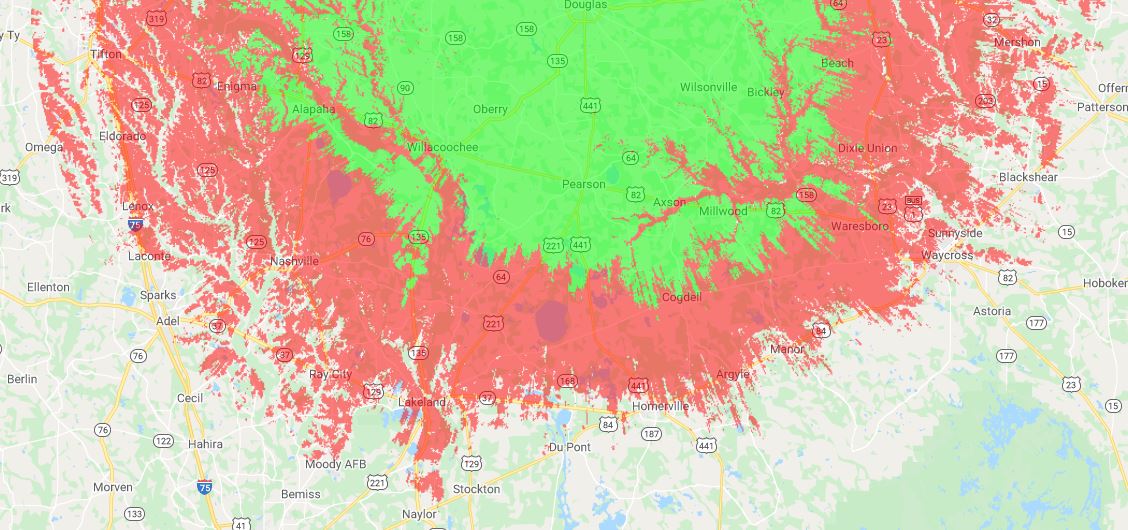
This is an ITM (Irregular Topography Map), also known as a Longley-Rice map. It accounts for signal strength vs land elevation and topography. Notice the signal strength dips nearest rivers and creeks such as the Satilla and Altamaha.
The GREEN depicts handheld units and lower-power mobile units. The RED depicts mobile units with 5/8 wave antennas and base stations with high gain antennas >10ft high. The repeater can be reached at much greater distances (with reports from McRae, Moultrie, Adel, Hoboken, and Valdosta) with a moderate base station with at least a 30ft high antenna mast.
0 Comments
Leave a Reply. |
Archives
July 2021
Categories |


